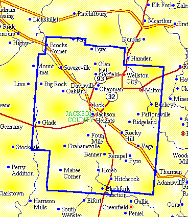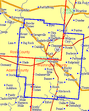
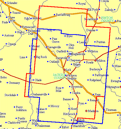
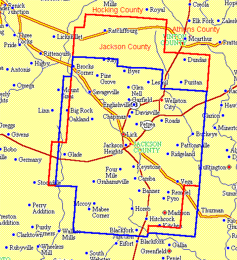
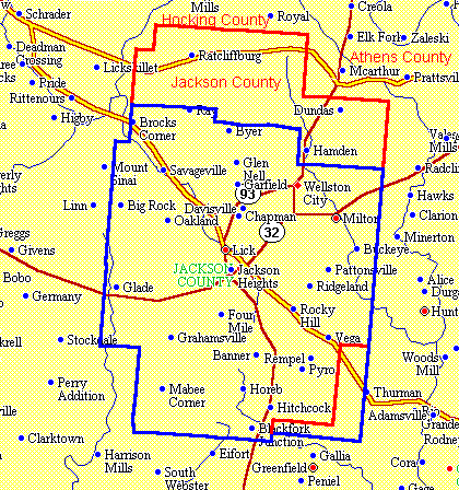
The following boundary changes have occurred over time for Jackson County, Ohio. The present-day boundaries of Jackson County are shown in blue and the boundaries at the time in question are shown in red. Where the boundaries were the same then as in the present, they are shown in the present-day blue. All of the boundaries are shown on a map that contains present-day towns and features to enable you to better locate the boundaries.
The following map shows the area that was later to become Jackson County as it existed in 1800.
The following map shows the area that was later to become Jackson County as it existed in 1810.
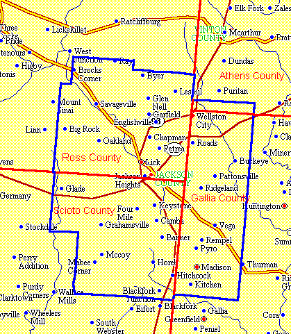
The following map shows Jackson County as it was originally created by the Act of Ohio passed 12 Jan 1816. It took effect on 1 Mar 1816.
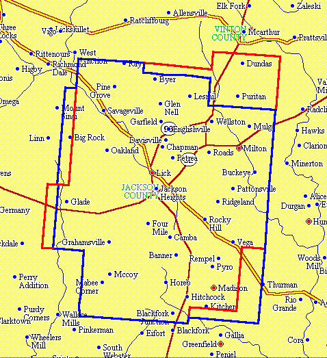
The following map shows Jackson County as it was changed by the Act of Ohio passed 3 Jan 1818. It took effect on 1 Mar 1818.
The following map shows Jackson County as it was changed by the Act of Ohio passed 11 Jan 1839. It took effect on 11 Jan 1839.
The following map shows Jackson County as it was changed by the Act of Ohio passed 7 Feb 1843. It took effect on 7 Feb 1843.
The following map shows Jackson County as it was changed by the Act of Ohio passed 23 Mar 1850. It took effect on 23 Mar 1850. It consists of two parts. Vinton County was created, which took part of northern Jackson County. At the same time, part of Gallia County was transferred to Jackson County. Jackson County's borders have not been changed since 1850.