If you know the legal description of the land, you can determine where the person lived. By observing the location of nearby towns, roads and streams, you may relate it to what is there now.
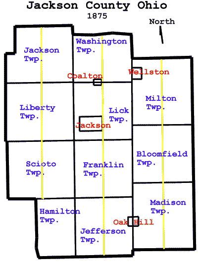
Each township (except Hamilton) is divided into a West and an East part to keep the file sizes down while allowing a large enough size image to easily read the landowners names. This division is purely a creation of mine to split the township files and has nothing to do with the actual townships. The division of each township is represented by the yellow lines on the county map. Click on the appropriate area of the map to see the desired part of the county. You can also click on the name of the township (shown after the map) to load the township's image. Note that in 1875 Coal Twp. had not yet been created between Lick and Washington townships.
Since these are large files and will take a while to load, I suggest that after you have the image, you right-click on the image and save it to your hard disk. Then you can look at the images all you want with your web browser or other image viewing software without having to reload it from the internet. These images will look better with your monitor set to 800x600 or higher because standard VGA (640x480) will make them appear very large and you will have to do a lot of scrolling.